Saturday, May 24, 2014

Going Buggy

* * *


I got to the gate a little before 7 a.m. and was surprised to see the sun already shining on the "Mount Tamalpais State Park" sign. I mentioned to the ranger who came to unlock the gate how weird that seemed since it was still so dark at this time of day just a few months ago, and she agreed, saying she feels like she's running late when it's this light out.


I was the first car through the gate and stopped to check out this vista point. I photographed a gorgeous post-7a.m. sunrise from here not that long ago.


By 7 a.m. these days the good light is almost over already. Almost.


I was a little disappointed to find it so windy on the mountain, but at least I'd left the cold and fog back in San Francisco. I was surprised to see how tall the grass has gotten in the meadow at Rock Spring, so I took a picture. 


I had the whole place to myself, and I enjoyed just poking around at a leisurely pace. In fact, I stopped so often and for so long that "pace" is probably not the right word for what I was doing. 

I tried not to be creeped out by finding European earwigs (etymology) in the mule ears blossoms. I suppose that old Night Gallery episode is responsible for some of the cringiness of them. They're actually kind of cute when they're just lounging around and eating nectar or pollen or whatever. It's only when they "scuttle" that they seem creepy, especially if they're scuttling toward you.

According to Powell and Hogue, this is the most abundant species in California, but it wasn't known in the state until 1923. It's interesting to think of the first earwigs coming over to California in some very specific location(s), then spreading out over much of the state. They are omnivorous, feeding on plants as well as dead and living insects, including aphids. When these guys realized they were being watched, they scuttled to the underside of the flower, returning topside when the coast seemed clear. Almost every mule ear blossom in this part of the meadow had a resident earwig.


There were many more species of grass in the meadow than I would ever have the patience or skill to identify, and you've got to hand it to the grasses for finding so many ways to express themselves.


The tiny beetle climbed up the grass stalk and flew away.


A little farther down the trail I spotted my first foxglove flowers of the season, though I've been watching the plants come up for a few weeks.


Here, a beetle forages on a cluster of blue dicks. Apparently you can know by the wing coloration of this species that this particular beetle is female. It's common name is dimorphic flower longhorn beetle.


I finally found a spot that was protected from the wind, allowing me to run the only focus stack of the morning on this checker bloom with a frothy mass of spittlebug larvae attached. 


On a much more "mature" checker bloom blossom I found this other species of flower longhorn beetle. I see this beetle every year and know it must be very common, but it's not covered in Powell & Hogue.


I guess it was just last week when Pam and I were hiking farther down the mountain that I couldn't recall if I'd ever actually seen one of these clicking critters. You hear them in the trees all around, but if you try to walk over toward the tick-tick-tick sound, it abruptly stops before you can zero in on it. I spotted this one because it was fluttering around on the ground next to the trail. It eventually climbed up onto this grass stalk where it was kind enough to allow me to photograph it at my leisure. 

To give you an idea how small these woodland cicadas are, my macro lens was set a 1:1 ratio in this shot, which is shown full-frame. Their genus, Platypedia, would appear to mean "flatfooted," which does not seem like their most obvious trait, if you ask me. There are 18 species in the genus in California, mostly in the northern half of the state.


I didn't go far down the trail before I turned around and headed back to the Jeep. I stopped along a drying-out seasonal streambed to look for snakes, but only found these witch's teeth.


I didn't find a snake until I almost ran over this sunbathing gopher snake. I didn't see him in time to stop, but I was at least able to drive over him without running him over. I parked just up the road and returned to snap this picture with the 50mm, then I nudged the snake so he'd slither off the road and into cover. As soon as I touched him, he reared up as if to strike, then hissed at me and slithered into the grass. Once he was all the way in the grass, he hissed again even louder for good measure.


I drove out along the road a ways to look for more snakes sunning themselves, but didn't see any more until the return trip. This small, baby rattlesnake was in the middle of the returning lane and had not been as lucky as the gopher snake. This little guy had to have been killed only a short time before I saw him since he hadn't been there when I first drove by.


I set him on this rock to get a better look at him, but the Jeep was idling in the middle of the road, so I made a quick snap and got moving again.


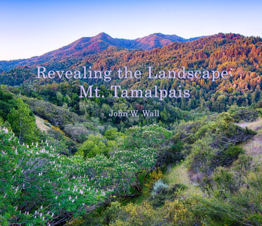
When I got home I found the latest ("final"?) version of my Mt. Tam book, which includes many of the D800E images I shot during the year of this blog. I got it with Blurb's highest quality papers, and it cost just over $200 with tax and shipping. You wouldn't want to spend that much on something for yourself -- but if you're lucky, maybe you'll get one as a gift. 

* * *

Raccoon & Fawns

* * *


I moved the camera to the other side of the little stream and strapped it to a higher tree branch for a different angle. I used this same branch once before and have caught raccoons here before as well.


At first I thought this was another frame of the same raccoon on the same night, and then I thought I was mistaken because the dates were different. But I wasn't mistaken. Same night, different sides of midnight.


These could very well be the two spotted fawns I caught in a previous camera trap just up the hill from this location.


The fawns were all over this little stream.


But I never caught mama.


Last fall this spot was getting quite a few visits from full-grown deer. Now these fawns will know about this spot and return throughout their lives. 


The bandit was my final catch for the week. This morning I moved the camera to yet another spot in this same area, but set at a much lower angle. I look forward to checking in again next week to see what critters have passed through.

* * *

Saturday, May 17, 2014

Mountain Home Loop

* * *


After grabbing the memory card from the camera trap farther up the mountain, we drove back down to hike a loop I've been wanting to do for a while.


Starting at the parking lot across the street from Mountain Home Inn, the loop would take us down Alice Eastwood Road (we were passed twice by motor vehicles heading to and from the campground) to Muir Woods, up the Bootjack Trail to Van Wyck Meadow, then back via the Troop 80 Trail. In this shot of Pam with the giant redwood tree, we're at a spur trail that links the Camp Eastwood Trail to the Bootjack without descending into Muir Woods at all.


We didn't use the spur. We wanted to see Muir Woods. It was only around 9 a.m., so it wasn't yet crowded down there. 


It was pretty down in Muir Woods, thanks in part to all the green of the new elk clover (Aralia californica) leafing out. The creek was still running and birds were singing, so the soundscape was nice too.


I was a little surprised to run into traffic way back beyond the Muir Woods boundary. This chatty group started hiking again as soon as we reached them. Unfortunately, we couldn't overtake them, so for some peace and quiet we stopped to rest and let them get well ahead of us, only to catch up to them and repeat the dance a couple more times before parting ways at Van Wyck Meadow.


I had never hiked the Bootjack Trail up out of Muir Woods before. It's gorgeous. Here, the newly minted canyon maple leaves (Acer macrophyllum) were the stars of the show.


We'll have to remember to bring a snack next time. This huge boulder next to the creek would have made an excellent picnic spot.


I figure this is the bridge whose reconstruction kept the trail closed for so long (after those trees in the ravine below smashed the last one). It's the most substantial bridge I've ever seen on the mountain, complete with steel girders.


The day started out cool, especially higher on the mountain where the north-facing exposure was quite windy. There was hardly any wind at all on the south side of the mountain, though, and none once we were down in the woods. The day became quite warm, and the trail was steep, so it was nice to find this accessible pool for a cool splash.


Parts of the trail were steep enough to require steps, and some of the steps had been made with old trail signs.


Here's a newer trail sign at Van Wyck Meadow ("Pop. 3 Steller's Jays"). According to my old (out of print) Olmsted & Bros. map, Van Wyck Meadow was a "[p]opular picnicking area in the 20's and 30's. Formerly called Lower Rattlesnake Camp. Named for Sidney M. Van Wyck, Jr., president of the [Tamalpais Conservation Club] in 1920-21. As a lawyer, he played an active role in agitating for a state park. The big rock in the middle of the meadow was called Council Rock."


There are many possible routes to continue hiking from the meadow. I'd thought about continuing uphill to pick up and return by the Matt Davis Trail, but I'd never hiked the Troop 80 Trail before and wanted to see it.


Unfortunately, as we soon found out, the trail was part of a race course! They came like this, one or two at a time. The trail is very narrow in most places, and sometimes the drop-off is deadly steep. You would not want to be accidentally bumped into a ravine, so we were glad to be able to let runners pass in wider sections of the trail.


Here, where the Sierra Trail meets the Troop 80, we finally parted company with the racers at an aid station. This junction is about 100 feet from the Panoramic Highway, but most of the Troop 80 Trail was not quite so close to the road. In any event, there was a lot more traffic on the trail than on the road!

We didn't rush the hike, but we didn't dawdle either, as I would have if I'd brought my "real" camera, so the 5-mile loop took us just about three hours. It's a nice hike through beautiful woods and along an interesting creek, but it can be a bit "civilized," especially with summer festivities coming on. Speaking of which, the Mountain Play began its new season today.

* * *

Casual Cat

* * *


I've put the camera trap in this location a couple of times before, but not from this angle. I like this spot because no hikers go here, yet it's close enough to the road that I can easily check on it, even if I'm tuckered out from a day's hike elsewhere on the mountain.


I was hoping to get more of a ground-level view of critters either passing through or stopping for a drink. On Tuesday I caught my first mouse, and only for three frames. Mice don't stay out in the open for long.


On Wednesday a lone turkey hen dropped by to get a drink. She stuck around just long enough to trigger the camera twice, for six frames.


I didn't get another hit until this Steller's jay dropped in on Friday -- yesterday. After I'd walked a good ways away from the set-up last Saturday, I was struck by a thought that ended up nagging me all week. Although I'd set the camera here before, I'd never done so when there was water running in the little defile. 

Would running water set off the camera trap? I was too tired, hungry and lazy to go back and check at the time, which condemned me to a full week of dreading the thought of dead batteries and a memory card full of nothing but riffling water. By mid-week I was thinking about driving all the way up there to check on it, but my loathing of rush-hour traffic was too strong.


As it turned out, I had no more animal-free frames than usual, and if I'd moved the camera somewhere else, I'd have missed this casual bobcat as he strolled through the scene yesterday afternoon. 

It was interesting to see that, even though the water in the scene did move, it didn't trigger the camera. I think the few blank frames I had were due to strong winds blowing and bending the surrounding trees, which made the shadows move.

* * *

Saturday, May 10, 2014

Yolanda-Worn Springs Loop

* * *


It was still crazy-windy when I went to bed last night, and I'd planned to remain in bed this morning if it hadn't calmed down. Luckily, it had -- at least enough. I've been planning to return to this spot along the Yolanda Trail since I first saw it just a couple of weeks ago. It was raining then, and the ravine full of California buckeyes wasn't in bloom yet. 

I was glad to get my shot at the break of day because the wind soon came up and spoiled everything. The morning light also got to be a bit much after a while, and I made another plan to return in the winter to shoot a blazing sunset from this spot. Of course, the foreground won't look so lush in winter. 

Anyway, this was really the only image I'd hoped to get today, so I spent the rest of the morning hiking a loop I'd never done before.


The plan was to hike out the Yolanda Trail to the junction where I turned downhill to Hidden Valley on my last trip. This time I would turn uphill at the junction to take the Yolanda to a fire road called the Worn Springs Trail. I figured it wouldn't be much farther to do that than to simply turn around and go back the way I'd come. There are some interesting rock outcrops above the Yolanda Trail, and I figured Worn Springs meandered just behind them.


I figured wrong. Not only was it a good ways to Worn Springs, but Worn Springs itself went steeply uphill at the trail junction. The Worn Springs Trail was not signed, so I had to choose between a gated dirt road that went downhill or the other dirt road that went up in a preposterously steep fashion. I'd brought my map for just such an occasion and regrettably realized I was supposed to go up the steep route. I think the gated route led to someone's home, since I soon saw a pick-up truck on the other side of a wire fence.


Three mountain bikers had passed me heading downhill along the Yolanda Trail, which I found annoying since the trail is narrow and is signed as being off-limits to bikes. Still, I'm amazed anyone rides a bike way up there and can negotiate the narrow trail without mishap. As I was huffing and puffing up the steepest part of the Worn Springs Trail I noticed someone was coming up behind me. And he was running. Not only that, but I think he was probably at least five years older than me.


The route rises way above the Yolanda Trail to an elevation of about 1,100 feet, then heads steeply back down to Phoenix Lake at about 200 feet, for about a five-and-half-mile round trip. The views are great up there, but it was quite windy and a bit chilly.The little sawtooth shape on the distant horizon is the San Francisco skyline.

* * *

Saturday, May 3, 2014

Cache Transaction

* * *


Heading up the Panoramic Highway this morning I had mixed feelings about the chaparral pea growing by the side of the road. Sure, I was glad to see the pretty blossoms. But I'm not a big fan of roadside photography. I like wild things, nature photography. Not pictures with roads in them. Nevertheless, I put my bias aside and hit the brakes to back up into a small turn-out. I've noticed that for a lot of photographers who visit Mt. Tam, the road itself is as much the subject as the landscape that surrounds it. And that's certainly the case for a lot of ad agencies marketing automobiles.


In any event, I was able to make a couple of pictures of the chaparral pea blossoms with only one car passing by, heading downhill, and I was glad I'd made the stop. I know the species grows higher up the mountain, but there was no guarantee it would be in bloom yet. 

When I finished with the pea flowers and continued driving up the mountain I soon spotted a significant bloom of western azalea, a species I'd particularly hoped to find today. I know it blooms along this south-facing roadside earlier than it does at my planned hiking destination of Potrero Meadow, but this time I decided not to stop. I guess I couldn't put aside my bias again quite that soon after my previous effort.


Once again I was waylaid by the simple beauty of Bolinas Ridge. This time it was easy to delay my hiking plans and stop for a little detour.


Springtime on Bolinas Ridge. What a great time of the year.


I finally got my hike under way and was surprised to find "fall color" in some fallen madrone leaves near the point where the Benstein Trail turns off the Lagunitas-Rock Spring fire road to drop down to Potrero Meadow.


There were a few azaleas blooming at Potrero Meadow, but I would say the full bloom of the northside azaleas (in their various locations) is still two or three weeks away. I probably wouldn't even have tried my luck this early, but I wanted to pick up the trail camera which I'd set out along the route to the meadow.


That there were so few flowers in bloom didn't really matter for my photographic purposes.


If I just wanted to photograph azaleas, and not "azaleas on Mt. Tam," I could have walked out my front door and found some growing in my neighborhood. It's funny, I guess, but I have no interest whatsoever in photographing azaleas in my neighborhood. But driving all the way up to Mt. Tam and hiking a few miles to find them growing on the edge of a meadow? Heck, yeah!


"Hmmm," I thought when I spotted something blue in the shrubbery. "An old beer bottle?"


A closer look revealed it was a geocache. When I got home, a quick google search revealed that it was this guy's geocache, set out almost three years ago, on August 9, 2011.


Here's what various geocache folks have left in the box since it's been out there. I'd have signed the log book, but the pen had dried out, so I left a calling card before placing it back where I found it. The logo on the gold foil packet is an Italian auto repair service, as near as I can tell. I guess it must be a gasket or seal of some kind.


Out in the meadow, my favorite orange-and-black plant bugs were having unprotected sex on the female plants of some meadow rue. (I'm thinking these are more likely to be Cosmopepla uhleri, actually.) I doubt the gold packet in the geocache would have been useful to them, however.


Wild rose.


Sitting out here with the iris in the middle of Potrero Meadow, the scent of onion was strong. All around me, wild onion plants were sprouting. They were probably a couple of weeks away from blooming. I also looked for the jimson weed that grows in the area but found no trace of it, outside of last year's stalks.

* * *